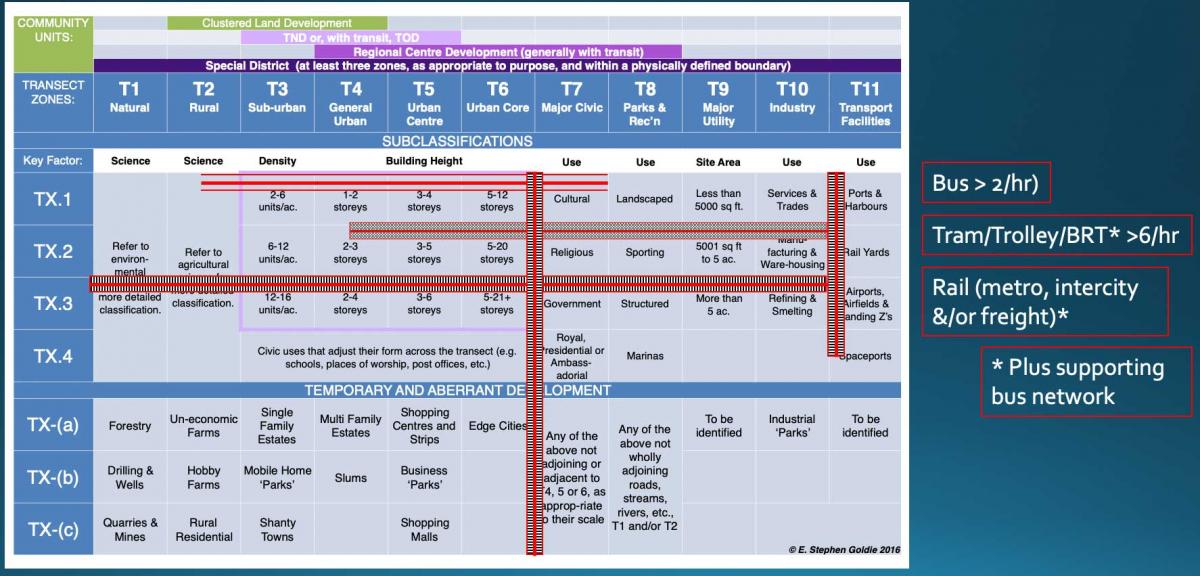
At CNU [Congress for the New Urbanism] 30 in Oklahoma City, planner Stephen Goldie presented an idea that has been in the works for several years, building on the rural-to-urban Transect. Goldie calls it the “Periodic Table of Urbanism,” see image at bottom, because it resembles the Periodic Table of chemistry.
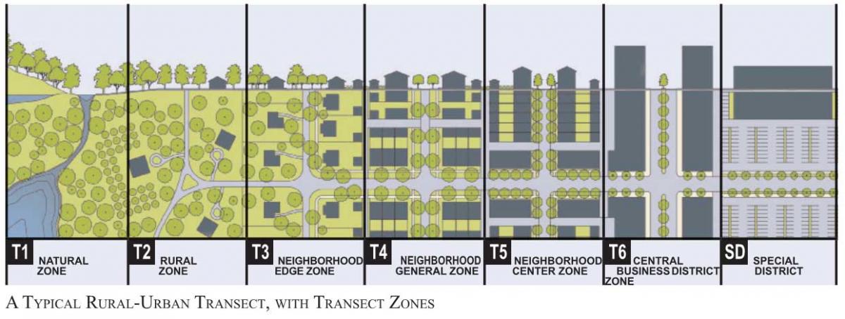
The idea is complicated and not for mass consumption—unlike the relatively simple Transect, shown below. The development of Transect-based planning is “one of the biggest events in the history of planning,” Goldie says—but he believes the current diagram oversimplifies cities and towns and needs to be expanded upon for the purposes of planning and urban design.

The “special districts” zone at the far right of the Transect is a catch-all for many kinds of widely divergent places, from industrial areas to airports, big-box commercial zones, universities, medical centers, government complexes, cemeteries, and more. Goldie developed the Periodic Table to more accurately describe special districts and various intensities of urbanism.
Special districts such as colleges, universities, and military facilities are better planned as a “community type,” like a traditional neighborhood development (TND), transit-oriented development (TOD), or regional center, Goldie says. These special districts are planned with multiple Transect zones. Goldie redefines the special district as "A special purpose community unit containing at least three urban-ecological zones within a physically defined boundary.”
Additionally, the table includes these features:
- The number of Transect zones is expanded in the table to include additional elements found in historic cities (e.g. major civic, parks and recreation, major utility).
- The table works vertically as well as horizontally. The urban-ecological zones get more intense moving down the chart (TX.1, TX.2, TX.3). This impacts the kinds of public transit available (see image below).
- The table even includes forms of sprawl and degraded landscape (expressed as TX minus).

